Waterloo Quadrant Analysis


The first image in this sequence shows the building massing in this quadrant of waterloo. This is one of the less densely built areas of waterloo when compared to other areas, and this is because it does not contain a great deal of residential buildings. Waterloo station and St.Mark's hospital are the two largest buildings in this area.
This quadrant has a large area of parkspace as well, as in the second image, with archbishop's park, Lambeth palace Gardens and Jubilee gardens. This is one of this area's greatest assets, and so these spaces are vitally important to be used to their full potential.
The third image shows the edges that define the quadrant. The river runs down the whole west edge, creating an edge that is virtually impermeable, other than by the 3 bridges that lead into the area at various stages along the river. Another heavy, definitive edge is created by the raised railway lines running out of waterloo station. Although this edge is quite attractive in places, it has a limited number of access points through it and some are very poorly maintained.
Edges are also created within the quadrant, mainly by the road network running through it. This can be seen on the last image in the sequence.


The first image shows the main issue that i have found with this quadrant of waterloo, and that is access. One area with poor access is between the area to the west of St.Thomas's hospital, at the north entrance to archbishop's park and the river walk. St.Thomas's hospital creates an impenetrable barrier between these areas. We walked down the river on a really cold day and it was like a wind tunnel walking down there, but once you are walking down this section of path, the only access is at the bridges at either end, which are quite a way apart and this can be seen in the second image.


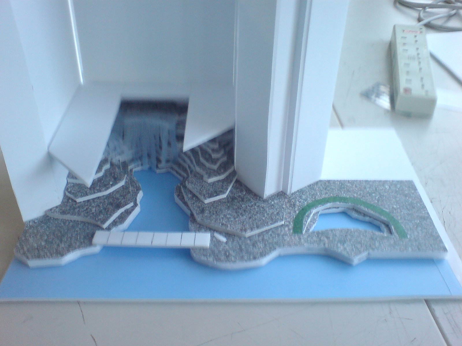
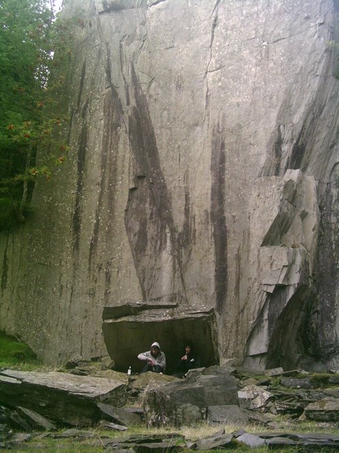
Another area of poor access is created by the raised railway lines running down the whole east edge of this area. Due to the raised railway lines, there can only be a few access points underneath. This would not be a problem in itself as it does help to break up and define the area, in a beneficial way. However the problem occurs because of the nature of some of the access points. The above image shows leek street, which runs underneath the lines near the train station. The underpass is empty, degraded with poor security measures. At certain times of day and at night, people are reluctant to use this cut through as it does not look safe or inviting to walk through. Because of this, the access from one side of the railway lines to the other is severly limited and people have to take a much longer diversional route around. This is a similar story to that of many of the access routes all along this edge.


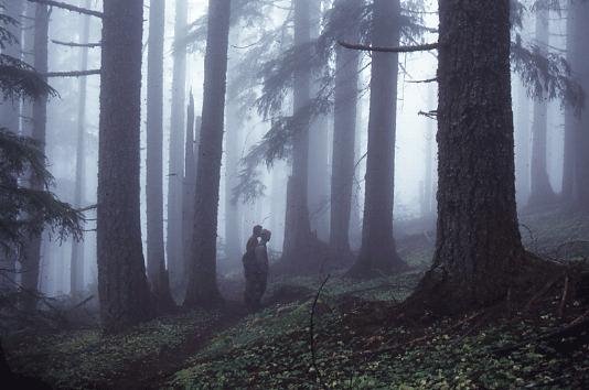
There are also issues of access into archbishops park and lambeth palace gardens. This is probably the largest area of park space within waterloo when accounted for together. However archbishop's park is too well hidden when it should be advertising itself as much as possible as it is an underused space, despite having great sports facilities. The above photo shows the park on a dull day, however it was a saturday afternoon and there was practically no-one using this large open space.

Architecture of yemen

"Celebrating the rich building traditions and architecture of Yemen, most famously the extraordinary multi-storey buildings that constitute the heart of many Yemeni cities, dating back hundreds of years but continually renewed and rebuilt by their inhabitants - an interesting example of living sustainable architecture that is both traditional and contemporary . The exhibition focuses on four major provinces; Dali', Yafi', Shabwah and Hadramut, and explores how this building culture - including the contribution made by master builders and inhabitants in the design process - and the fabric and environment of Yemeni towns itself, is increasingly under-threat from commercial construction and corporate urban development. "

The exhibition was small scale, but gave a interesting overview of the unique architecture in this part of the world, and also the modern development issues that are challenging it. One of the highlights of the exhibition was the display of models, which were really detailed and showed the diversity of architectural style and layout.


The exhibition also had a good display of structural drawings and methods, details of materials and detailing associated with Yemeni architecture, as well as a projector displaying general images of culture and lifestyle within the region to support the exhibition.


Anthony McCall @ Serpentine Gallery

The exhibition at the serpentine gallery is of work by British artist Anthony McCall. McCall has a "cross-disciplinary practice in which film, sculpture, installation, drawing and performance overlap." A key figure in the avant-garde London Film-makers Co-operative in the 1970s, his earliest films are documents of outdoor performances that were notable for their minimal use of the elements, most notably fire.


The exhibition consists of simple projections that strikingly emphasise the sculptural qualities of a beam of light. In darkened, haze-filled rooms, the projections create an illusion of three-dimensional shapes, ellipses, waves and flat planes that gradually expand, contract or sweep through space. In these works, the artist sought to deconstruct cinema by reducing film to its principle components of time and light and removing the screen entirely as the prescribed surface for projection. The works also shift the relationship of the audience to film, as viewers become participants, their bodies intersecting and modifying the transitory forms.

The exhibition was supported by the concept sketches and drawings produced by McCall. Experience was a big key to the success of the exhibition, for me personally. The way the projections of light reacted to people passing through them was captivating to watch.


Diana Memorial Fountain


Visited the Dianna Memorial Fountain for the first time on the way to the serpentine gallery.There are some nice elements to the fountain such as the dual-directional movement of the water, and the features that reflect some of the features found in a natural river system. However it isnt particularly inspiring, or specific in it's commemoration, and appears to have some ongoing maintenance issues.

Waterloo transport analysis


I was looking at the transport services offered in waterloo. The first image in the sequence shows the main road network that runs through waterloo. It also shows public car parks. Car ownership in this area is comparatively low. waterloo is inside the congestion charge zone and also has great public transport services, causing the reduced use of cars, which benefits the area. You can see how well the area is served by public transport from the 2nd and 3rd images. the second shows the location of bus stops in waterloo. There aren't really any areas that you could say were not served by a nearby bus stop. The most obvious transport associated with waterloo is the train station. This is one of london's main stations and is a huge part of the area's character. As well as waterloo and waterloo east, the area is also served by southwark and lambeth north tube stations, increasing transport links to and from the area.
The fourth image shows the proposed cross river tram route. This is a new transport link connecting Euston and Waterloo, with branches to Camden Town and King's Cross in the north, and Brixton and Peckham in the south. This will further reduce congestion in the area and add another attractive transport service to waterloo.

zaha hadid @ design museum


The Zaha Hadid exhibition at the design musem offered some really nice and varied work. There was a large range of different graphical techniques, as well as some great models and projections.

Two lover's nest: paddington basin

Initial concept


These were the initial landform models for the imaginary canalside site. the initial idea showed the nest being sculpted from the shape of the land, and becoming a safe, secluded nest that may be surrounded or covered.


I looked at examples of secluded, private nests as this is the kind of nest that was required by the two people who who be using it. I also started looking at waterfalls as the veil of water created by them creates an elegant covering.


I then tried to develope the landform further, and had the nest dug down into the ground so that it was protected most of the way around, and would be less visible and more secluded.i also looked into creating a roof covering that water could run over to create a water veil, covering most of the open part of the nest which then flowed into the canal.


This is the final concept image, which was a photograph of a model worked over on computer. It shows the main ideas for the nest: a secluded place that is on the threshold between land and water.


Paddington basin: proposed site


This photo shows the extent of the actual site in paddington basin.


These photos show the canal side site


This was a quick sketch model made after the visit to the site which was to try applying the concept to the shape of the site


This is a plan and section of the site as it is


I looked at precedent projects that had used water and waterfalls. I wanted to design in such a way that the forms and shapes would take inspiration from natural forms that occur in the relevant geographical processes. The precendents that interested me the most were Frank Lloyd Wright's 'Fallingwater', which mimics its natural surroundings such as the way the rock lies, and also fountains by Lawrence Halprin, which used ragged, irregular contoured levels which looked as though they had been cut by hydraulic action.


I started working over the base plan and section of the existing site, changing the topography and the area of the edge in contact with the canal. I tried to create shapes that looked like they could have been carved out by the action of the water. I looked at the plunge pull and the undercut created at the base of the waterfall and applied this in section.


first development model, shows how the topography would look in 3d, with the nest area being a carved out area that would be behind the veil of water.


this was a photo of the model rughly applied to a photograph of the site to get a feel of how such a landform may look in the real setting.


I looked back at the intial concept and looked at sinking the nest underground, which would have made it more private. However it would have removed the proximity of the water from the people useing the nest, and i think this would have taken something away from the whole point of using the waterfall.

I also tried to work out other natural looking forms for the 'public' area, which was to provide an area for other people to use, and to be a sort of ' diversional' area to draw attention away from the nest.


this model was based on the nest buried under the ground.


This image was to show how the waterfall and topography would look on the paddington site.


This is the final model. It shows the waterfall with the nest behind it. the walk up to the waterfall is not obvious in order to keep it as a sanctuary for the two clients. There is a small pool with areas around it for seating for other office workers and members of the public to use

Kingston Gateways


The aim of the project was to create a new gateway into kingston town. This meant looking at what a gateway is and what it signifies, and the many forms and scales that a gateway can take. This meant researching existing gateways from around the world.


There are several gateways into kingston that kingston council had already indicated, however i looked into other possible gateway sites that i thought may be a significant enough entrance point that a gateway could be justifyable in such a location. i decided that my focus gateway would be at the site of kingston bridge as this seemed a significant entry point between two towns, as well as two counties, and to me seemed to be the most impressive and significant gateway site that could be made into something that would become synonymous with entry into kingston


The site analysis of kingston bridge showed 3 main factors for consideration. The first of these was the divergence of the various users of this gateway as they entered the town. Cyclists and pedestrians split in a different direction to vehicles as they passed the gateway point. Also, one of the gateways key features was the line of sight down the high street when travelling into the town. The other factor was the area that was not an efficient use of space as it was currently a single bench facing a brick wall planter.


My idea for the new gateway was a composite fabric structure which would be wide enough that every person passing through the gateway, by whichever mode of transport would pass underneath it and feel the effect of approaching, being on the threshold of, and arriving into the town. It would also have an open section at the back as you are approaching so that the line of sight down the highstreet is almost framed in a window in the structure, so that as you drive past you get a snapshot of one of modern kingston's best known assests- its shops.

This plan of the proposed gateway also shows a re-developed area just inside the gateway as this area was previously under-utilised. By adding new, more sensibly layed out seating as well as grass and plated areas, it provides an area where people can sit and relax as well as something more noticeable and pleasant to pass through for the pedestrians and cyslists entering the town.