Showing posts with label my work. Show all posts

model experimentation

was bored so made some quick experimental sketch models
using lighting techniques

2nd year exhibition : waterloo gallery

this was the exhibtion space in the waterloo gallery. the space was nice and had a smaller area upstairs as well.

This is the work i produced for the exhibtion:


Wapping Waterfront project

This is some of my work for the project on
the waterfront site in wapping, london.


college roundabut exhibition


This was the exhibition of the college roundabout
project shown previously on this blog, and it was
held in the market hall in Kingston. It was good to
see our work being shown to the public, and being
there for a while to see what a wider demographic
thought of the projects.

Waterloo Quadrant Analysis


The first image in this sequence shows the building massing in this quadrant of waterloo. This is one of the less densely built areas of waterloo when compared to other areas, and this is because it does not contain a great deal of residential buildings. Waterloo station and St.Mark's hospital are the two largest buildings in this area.
This quadrant has a large area of parkspace as well, as in the second image, with archbishop's park, Lambeth palace Gardens and Jubilee gardens. This is one of this area's greatest assets, and so these spaces are vitally important to be used to their full potential.
The third image shows the edges that define the quadrant. The river runs down the whole west edge, creating an edge that is virtually impermeable, other than by the 3 bridges that lead into the area at various stages along the river. Another heavy, definitive edge is created by the raised railway lines running out of waterloo station. Although this edge is quite attractive in places, it has a limited number of access points through it and some are very poorly maintained.
Edges are also created within the quadrant, mainly by the road network running through it. This can be seen on the last image in the sequence.


The first image shows the main issue that i have found with this quadrant of waterloo, and that is access. One area with poor access is between the area to the west of St.Thomas's hospital, at the north entrance to archbishop's park and the river walk. St.Thomas's hospital creates an impenetrable barrier between these areas. We walked down the river on a really cold day and it was like a wind tunnel walking down there, but once you are walking down this section of path, the only access is at the bridges at either end, which are quite a way apart and this can be seen in the second image.


Another area of poor access is created by the raised railway lines running down the whole east edge of this area. Due to the raised railway lines, there can only be a few access points underneath. This would not be a problem in itself as it does help to break up and define the area, in a beneficial way. However the problem occurs because of the nature of some of the access points. The above image shows leek street, which runs underneath the lines near the train station. The underpass is empty, degraded with poor security measures. At certain times of day and at night, people are reluctant to use this cut through as it does not look safe or inviting to walk through. Because of this, the access from one side of the railway lines to the other is severly limited and people have to take a much longer diversional route around. This is a similar story to that of many of the access routes all along this edge.


There are also issues of access into archbishops park and lambeth palace gardens. This is probably the largest area of park space within waterloo when accounted for together. However archbishop's park is too well hidden when it should be advertising itself as much as possible as it is an underused space, despite having great sports facilities. The above photo shows the park on a dull day, however it was a saturday afternoon and there was practically no-one using this large open space.

Waterloo transport analysis


I was looking at the transport services offered in waterloo. The first image in the sequence shows the main road network that runs through waterloo. It also shows public car parks. Car ownership in this area is comparatively low. waterloo is inside the congestion charge zone and also has great public transport services, causing the reduced use of cars, which benefits the area. You can see how well the area is served by public transport from the 2nd and 3rd images. the second shows the location of bus stops in waterloo. There aren't really any areas that you could say were not served by a nearby bus stop. The most obvious transport associated with waterloo is the train station. This is one of london's main stations and is a huge part of the area's character. As well as waterloo and waterloo east, the area is also served by southwark and lambeth north tube stations, increasing transport links to and from the area.
The fourth image shows the proposed cross river tram route. This is a new transport link connecting Euston and Waterloo, with branches to Camden Town and King's Cross in the north, and Brixton and Peckham in the south. This will further reduce congestion in the area and add another attractive transport service to waterloo.

Two lover's nest: paddington basin

Initial concept


These were the initial landform models for the imaginary canalside site. the initial idea showed the nest being sculpted from the shape of the land, and becoming a safe, secluded nest that may be surrounded or covered.


I looked at examples of secluded, private nests as this is the kind of nest that was required by the two people who who be using it. I also started looking at waterfalls as the veil of water created by them creates an elegant covering.


I then tried to develope the landform further, and had the nest dug down into the ground so that it was protected most of the way around, and would be less visible and more secluded.i also looked into creating a roof covering that water could run over to create a water veil, covering most of the open part of the nest which then flowed into the canal.


This is the final concept image, which was a photograph of a model worked over on computer. It shows the main ideas for the nest: a secluded place that is on the threshold between land and water.


Paddington basin: proposed site


This photo shows the extent of the actual site in paddington basin.


These photos show the canal side site


This was a quick sketch model made after the visit to the site which was to try applying the concept to the shape of the site


This is a plan and section of the site as it is


I looked at precedent projects that had used water and waterfalls. I wanted to design in such a way that the forms and shapes would take inspiration from natural forms that occur in the relevant geographical processes. The precendents that interested me the most were Frank Lloyd Wright's 'Fallingwater', which mimics its natural surroundings such as the way the rock lies, and also fountains by Lawrence Halprin, which used ragged, irregular contoured levels which looked as though they had been cut by hydraulic action.


I started working over the base plan and section of the existing site, changing the topography and the area of the edge in contact with the canal. I tried to create shapes that looked like they could have been carved out by the action of the water. I looked at the plunge pull and the undercut created at the base of the waterfall and applied this in section.


first development model, shows how the topography would look in 3d, with the nest area being a carved out area that would be behind the veil of water.


this was a photo of the model rughly applied to a photograph of the site to get a feel of how such a landform may look in the real setting.


I looked back at the intial concept and looked at sinking the nest underground, which would have made it more private. However it would have removed the proximity of the water from the people useing the nest, and i think this would have taken something away from the whole point of using the waterfall.

I also tried to work out other natural looking forms for the 'public' area, which was to provide an area for other people to use, and to be a sort of ' diversional' area to draw attention away from the nest.


this model was based on the nest buried under the ground.


This image was to show how the waterfall and topography would look on the paddington site.


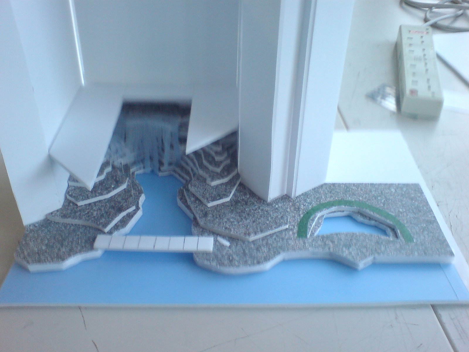
This is the final model. It shows the waterfall with the nest behind it. the walk up to the waterfall is not obvious in order to keep it as a sanctuary for the two clients. There is a small pool with areas around it for seating for other office workers and members of the public to use